We made it! Today, we successfully reached the summit of Gunung Kerinci, the highest volcano in Indonesia!
As scheduled, Kimon roused me at 3 am. Despite feeling tired, the anticipation of reaching the summit fueled my excitement. I had a modest breakfast consisting of a cup of tea and half a pack of cookies before embarking on our hike from Shelter 2 to Shelter 3. The previous night, I experienced several interruptions in my sleep due to the freezing cold. Despite wearing layers such as boxer shorts, thermal trousers, pajama trousers, normal trousers, thermal shirt, pajama shirt, and a sweater, along with being snug in my sleeping bag, I found myself waking up occasionally during the night to rezip the sleeping bag that had come undone.
Exhausted
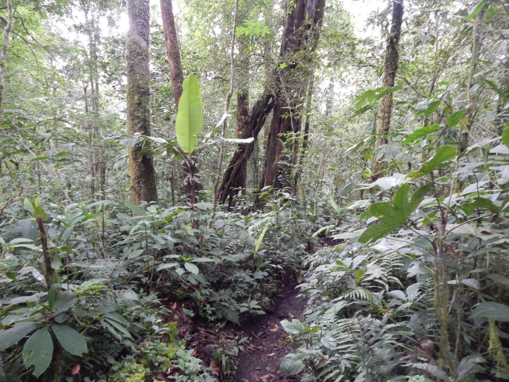
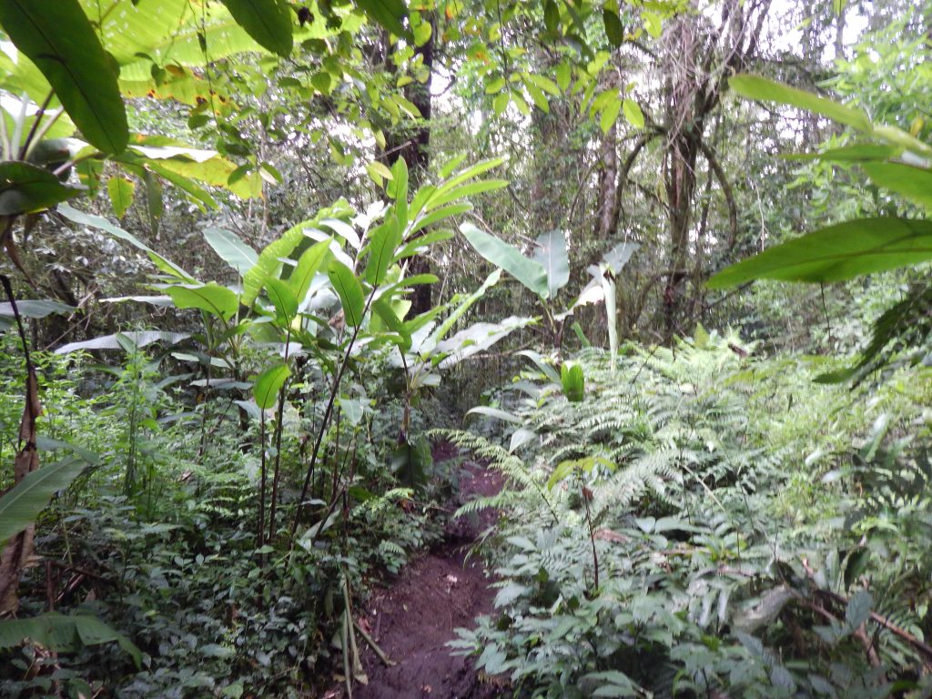
The trek from Shelter 2 to Shelter 3 proved to be demanding! The path involved high elevations, steep sections, and a distinct lack of horizontal inclines. Fortunately, equipped with hand gloves, I could confidently grip every thorny branch and root along the way. It was a momentous occasion to finally make use of the head torchlight I had purchased specifically for this global journey.
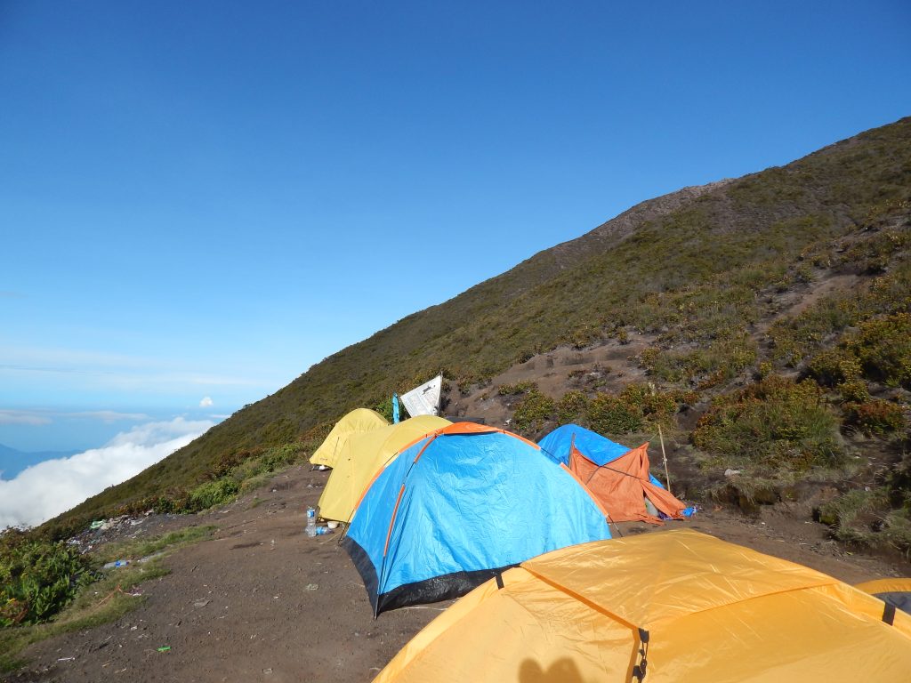
Kimon and I maintained a brisk pace, benefitting from the reduced weight as we left our backpacks stored in our tents at Shelter 2. Upon reaching Shelter 3, a mix of exhaustion and determination engulfed me. At the campsite, we observed fellow climbers awakening and gearing up for their ultimate push toward the summit of Gunung Kerinci.
Final Stretch
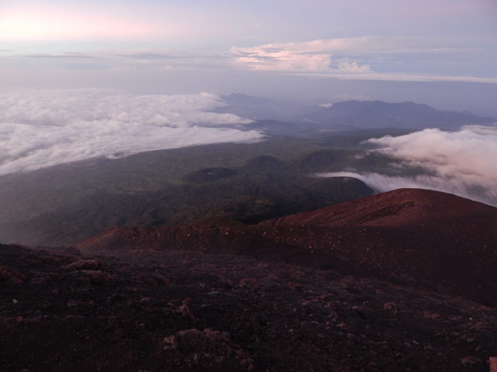
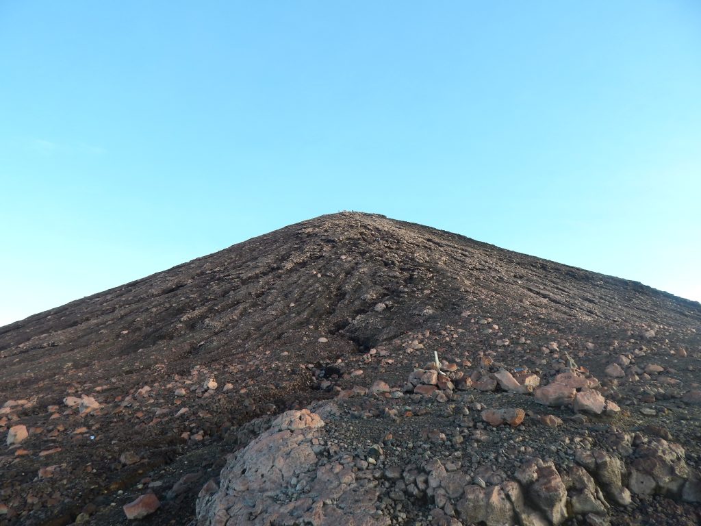
Kimon reassured me that it was only a one-hour journey to the summit from Shelter 3. However, it turned out to be around two hours, and the most challenging segment awaited us. Beyond Shelter 3, the landscape transformed, devoid of vegetation, and the ground transitioned to loose soil, increasing the risk of slipping. The familiar jungle dirt path had given way to rocky terrain, scattered with scree.
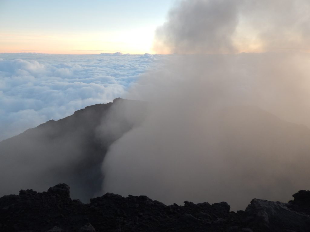
During our ascent to the summit, the surroundings were still veiled in darkness, and ahead of us, I discerned a looming shadow resembling a massive hill. We pressed on, adopting a ‘slowly, slowly’ approach, an intense and precarious endeavor for me. The scree presented some genuinely nerve-wracking moments. In this segment of our climb, I experienced about 10 slips today, both ascending and descending Gunung Kerinci’s summit. Each time I slipped, the fear that gripped me was profound. To be honest, had I known about these challenges beforehand, I might not have entertained the idea of climbing this mountain, haha. Yet, looking back, rewriting this narrative, every bit of it was undeniably worthwhile!
Summit Surprises
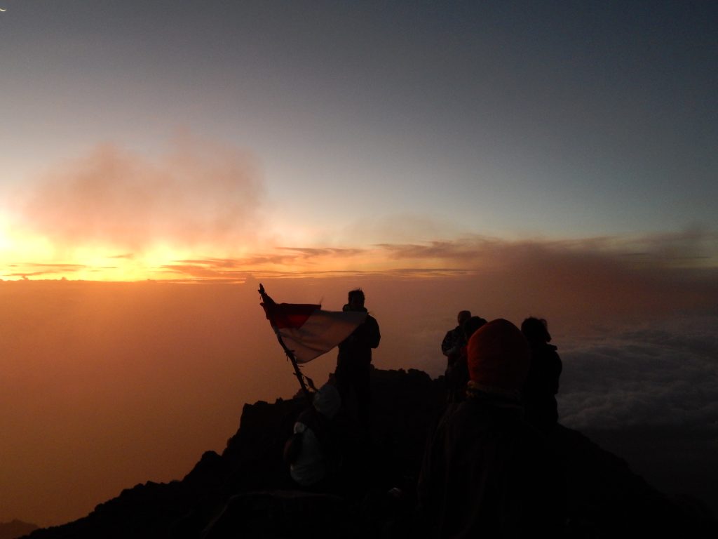
Upon conquering the initial shadowy hill, which I had mistaken for Gunung Kerinci’s summit, a looming dark hill emerged in the distance. My heart sank; the true summit was still ahead. The disheartening pattern repeated itself about 30 minutes later when yet another hill materialized. Frustration set in, and I directed a bit of annoyance toward Kimon, as it was undoubtedly taking longer than an hour. In retrospect, I should’ve been mindful of the Indonesian time perception, where one hour is not just one hour, but perhaps two or even three.
The trek from Camp 3 to the summit lasted two and a half hours, maintaining a deliberate pace. The experience was extraordinary as I witnessed sights I had never encountered before. Multiple falling stars streaked across the sky, and in the far distance, their impact with the atmosphere produced a luminous thunder flash—an enchanting and surreal moment.
Arrival at Gunung Kerinci’s Summit
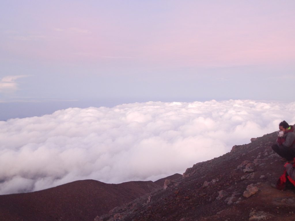
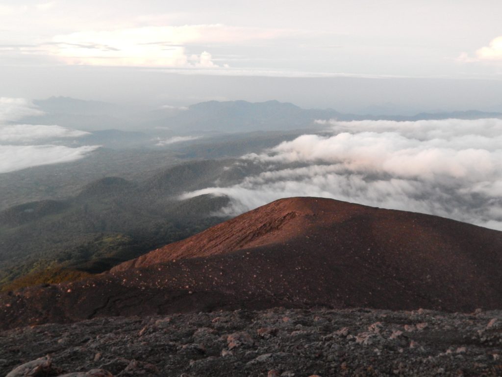
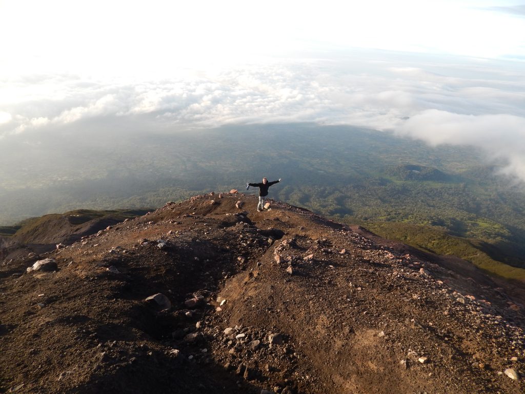
Exhausted, I reached the summit of Gunung Kerinci, the pinnacle of Sumatra. Standing at an altitude of 3805 meters above sea level on the elevated western rim, I struggled for breath. Climbing approximately 2300 meters in the past 24 hours, it’s no wonder I appear like a zombie in the pictures.
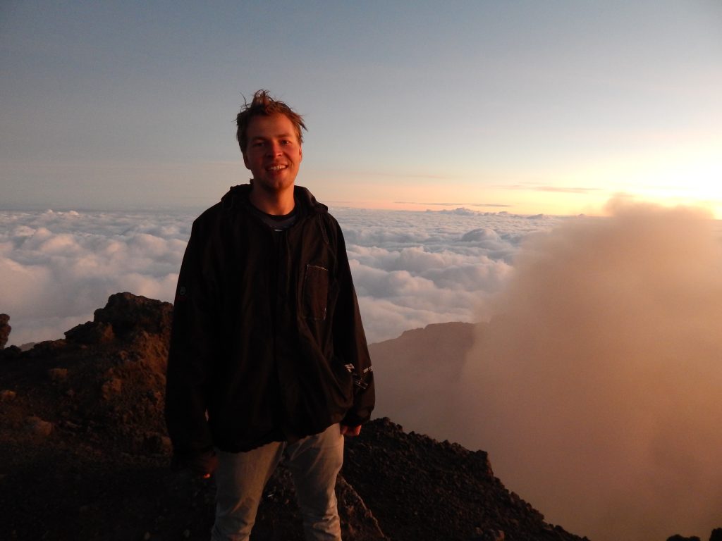
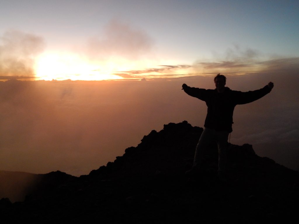
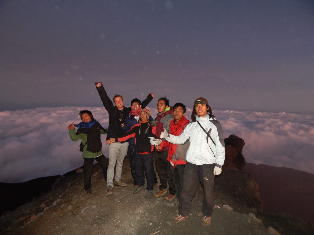
I didn’t linger on my fatigue for too long; excitement quickly took over. Eagerly, I wanted to explore the area and catch a glimpse into the crater. However, my attention shifted to a group of Indonesian students who warmly greeted and congratulated me. Naturally, they insisted on having a picture with the bule. Although they had already taken plenty of pictures with me the day before, this was evidently a special moment. I joked about charging them a special price for the photograph due to the stunning scenery. We all shared a laugh and took some pictures together.
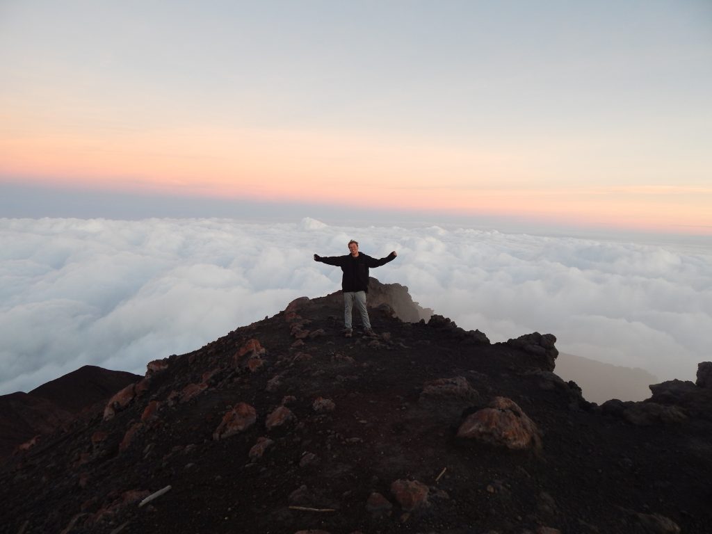
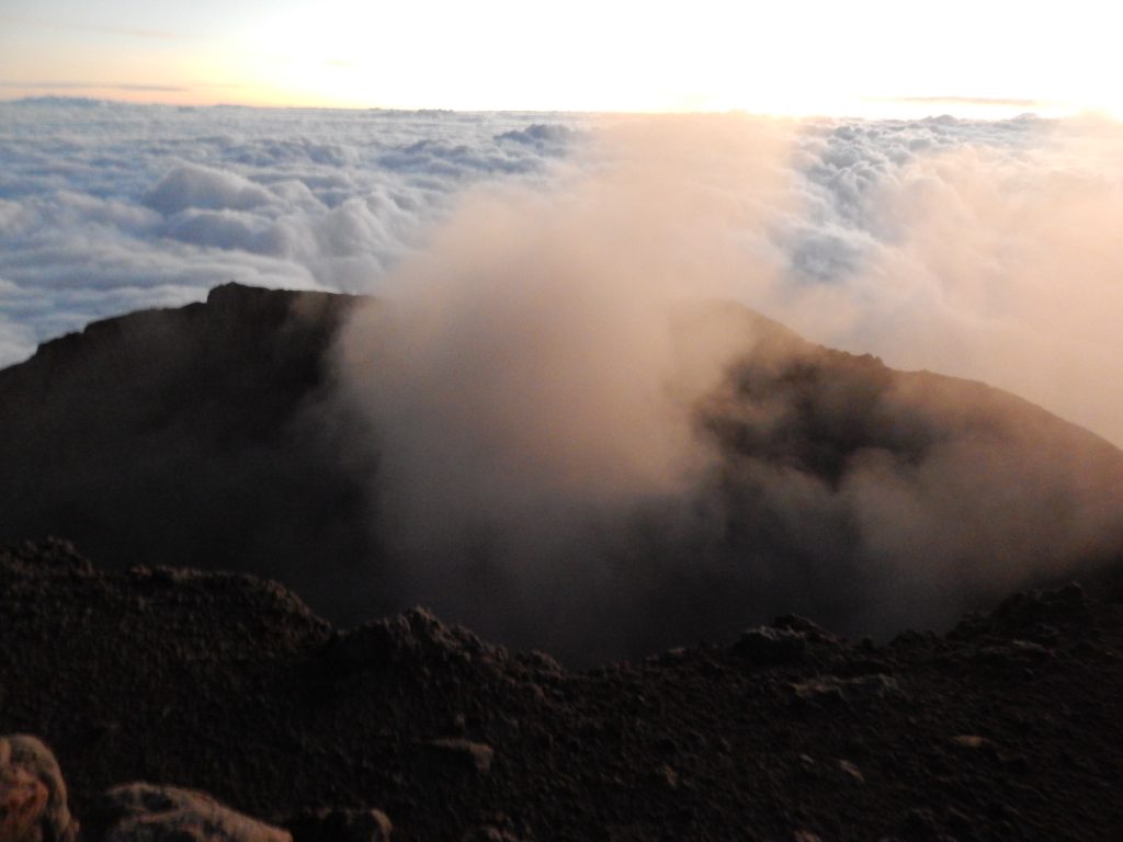
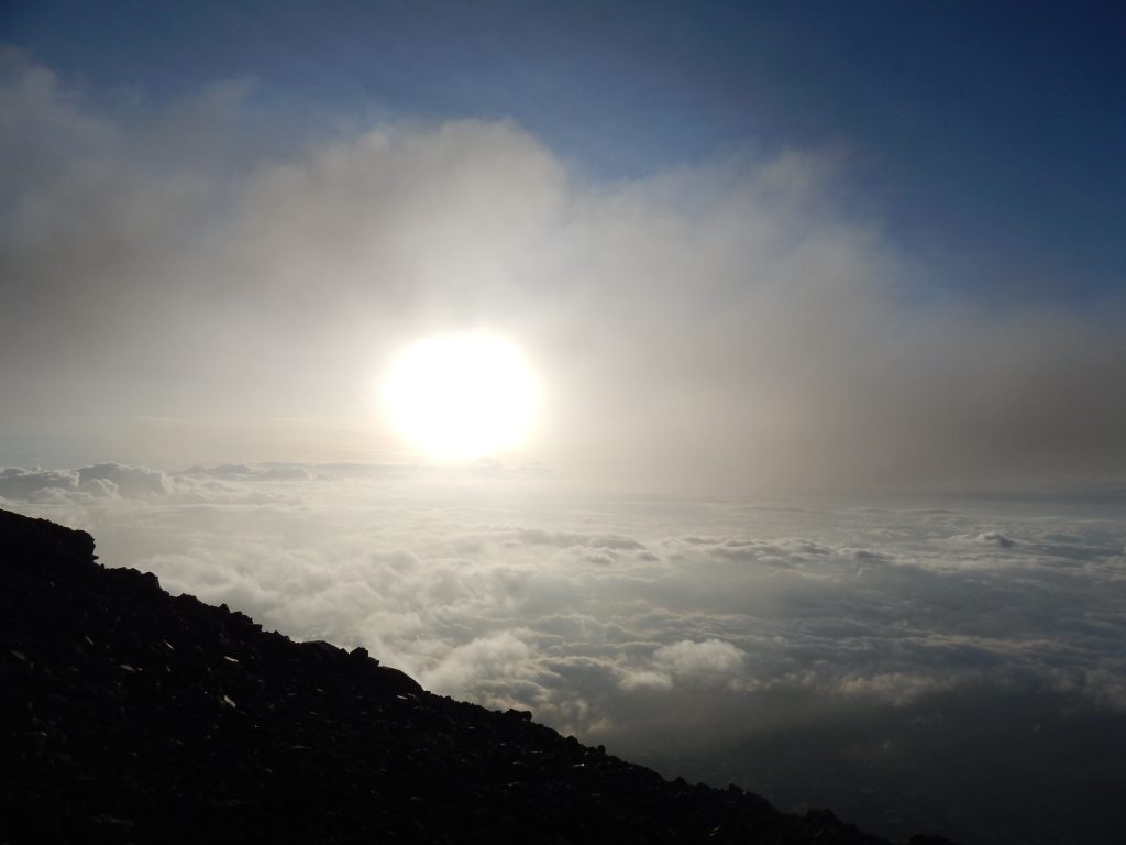
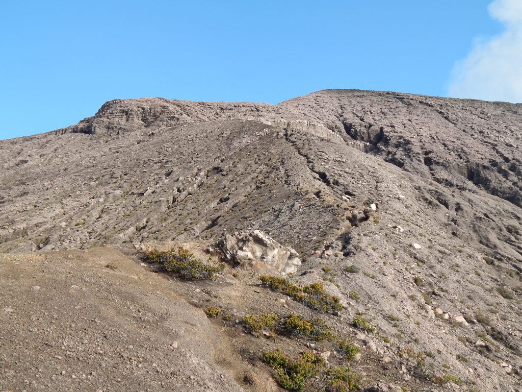
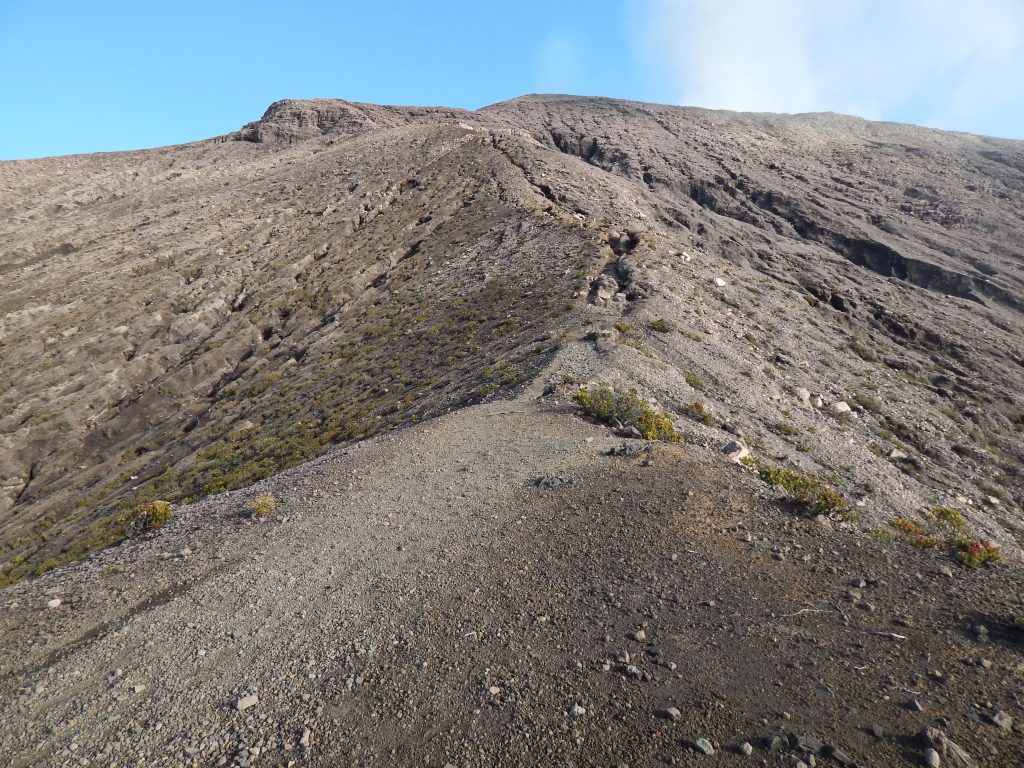
The views were obscured by clouds, slightly disappointing, but the sunrise in this location is truly magical! Once the sun bathed everything in its light, I realized we were positioned high above the cloud cover. The peak area was finally visible, and it struck me how small the area was! As depicted in the crater pictures, it’s too steep to venture to the other sides. Attempting to reach there would be a perilous undertaking.
Navigating the Terrain: Breakdown of the Gunung Kerinci Summit Route
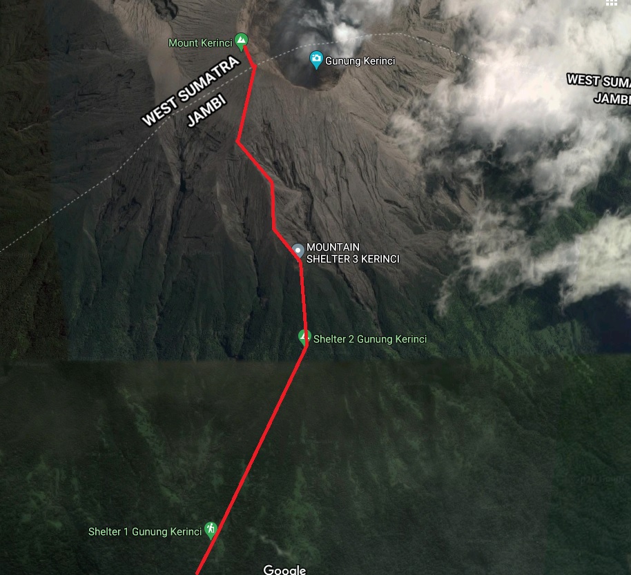
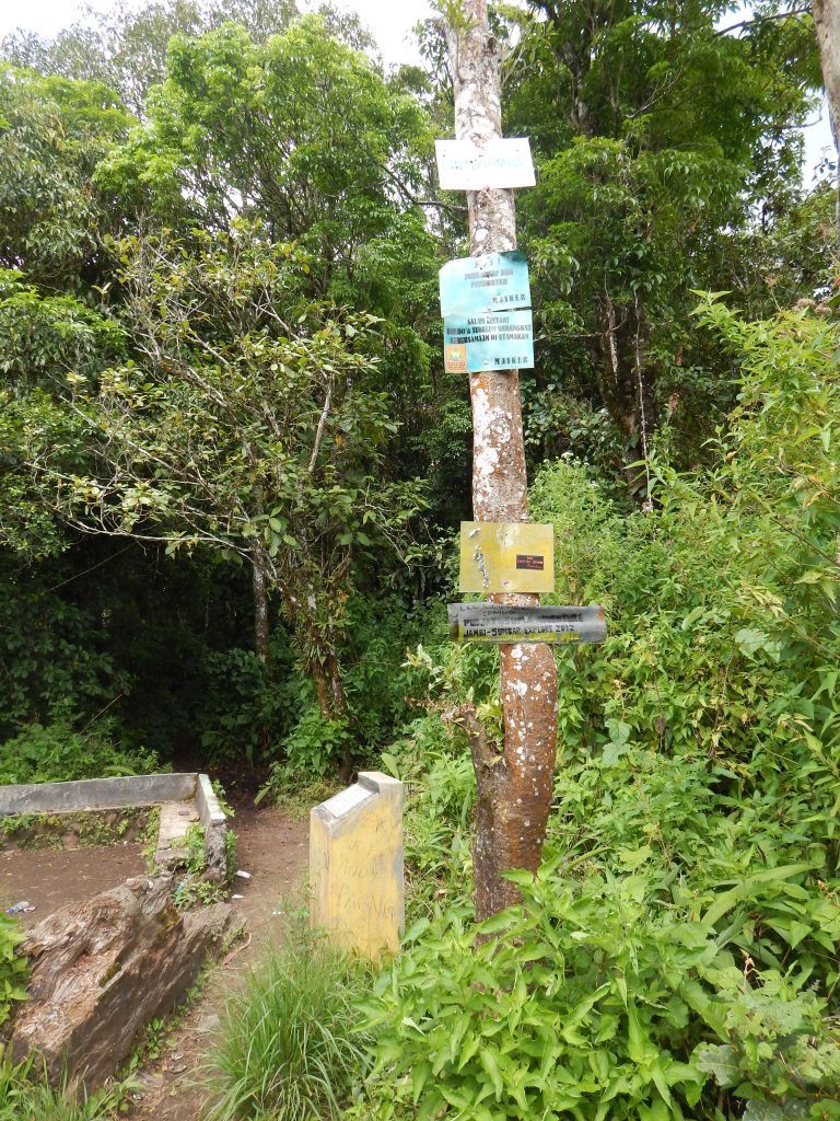
The peak area of Gunung Kerinci is situated on the western/south-western side of the crater, and Google Maps provides a comprehensive overview of the region. I’ve outlined the route we just completed below. The distance from the entrance to Shelter 1 is approximately 2.6 kilometers. Following that, from Shelter 1 to Shelter 2, it’s 1.4 kilometers. The more challenging jungle segment begins at Shelter 2, and the distance from Shelter 2 to Shelter 3 is only 500 meters. Finally, the distance from Shelter 3 to the summit is around 1.1 kilometers.
Once more, the distance doesn’t tell the full story, as the incline and difficulty intensify at each stage. To offer some perspective: the total elevation gain from the entrance to the summit of Gunung Kerinci is 2300 meters. Dimitrios, a blogger, undertook a solo hike to the summit of Gunung Kerinci and shares his experiences in a compelling travel narrative. Towards the end of the page, he includes another informative map of the route.
The Final Challenge
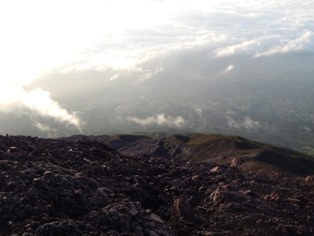
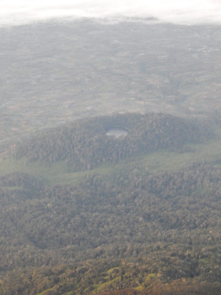
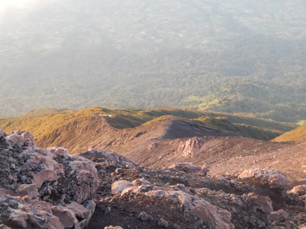
Occasionally, I managed to capture breathtaking landscapes, primarily from the southern perspective at the summit. Unfortunately, the cloud cover obscured other vistas. Nevertheless, my time at the summit was delightful. I could discern the small, roundish lake, Danau Belibis, situated on the left side (when facing Gunung Kerinci) of the entrance path. In the first picture below, you can discern the trail winding through the jungle south of Danau Belibis if you look closely. It dawned on me that another physical challenge lay ahead – the safe descent back to Kersik Tuo.
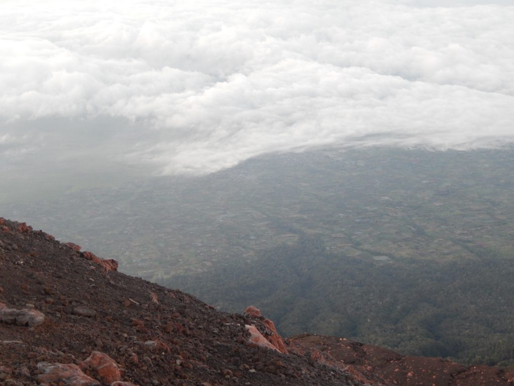
After an hour, I informed Kimon that I was ready to begin our descent. Kimon seemed a bit perplexed by my decision to leave so soon. The panoramic views of the crater of Gunung Kerinci and the surrounding landscapes from the mountain’s peak were truly breathtaking!
Descending Gunung Kerinci’s Summit
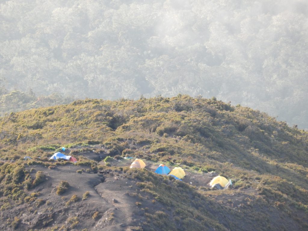
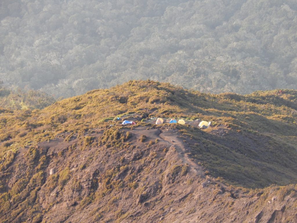
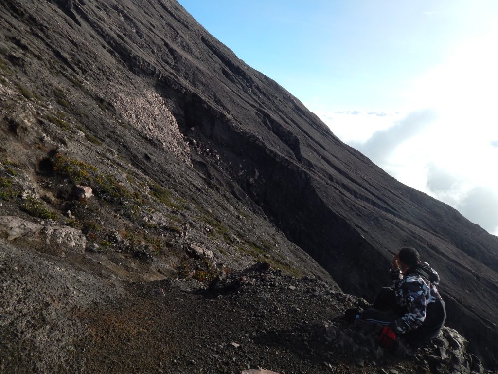
After spending an hour at the summit of Gunung Kerinci, Kimon and I embarked on our descent back to the park entrance. I’ve never been so cautious with my steps before; the scree slope was incredibly perilous. While descending the first steep hill part, I experienced a few slides, heightening my nerves. During our descent, we made several stops to capture the stunning scenery. In the gallery below, you can find pictures of the Shelter 3 encampment taken from two different vantage points—both from the peak and near the encampment, some with the use of optical zoom.

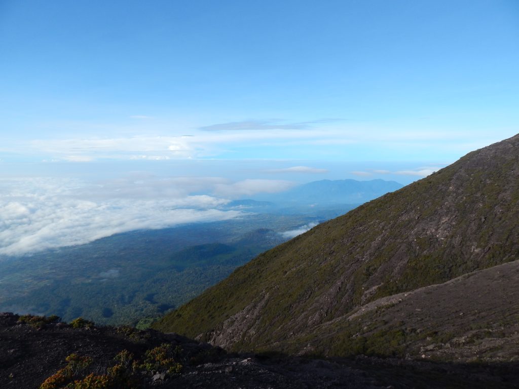
While descending, I captured numerous pictures of the hills we had just descended, the clouds below us, and the steep mountainsides of Gunung Kerinci. The views from this vantage point were breathtaking, offering a unique perspective of the pathway that remained hidden in the darkness during the ascent. Now, I could truly appreciate the beauty of the surroundings, as opposed to the ascent when my focus was solely on my physical and mental state.
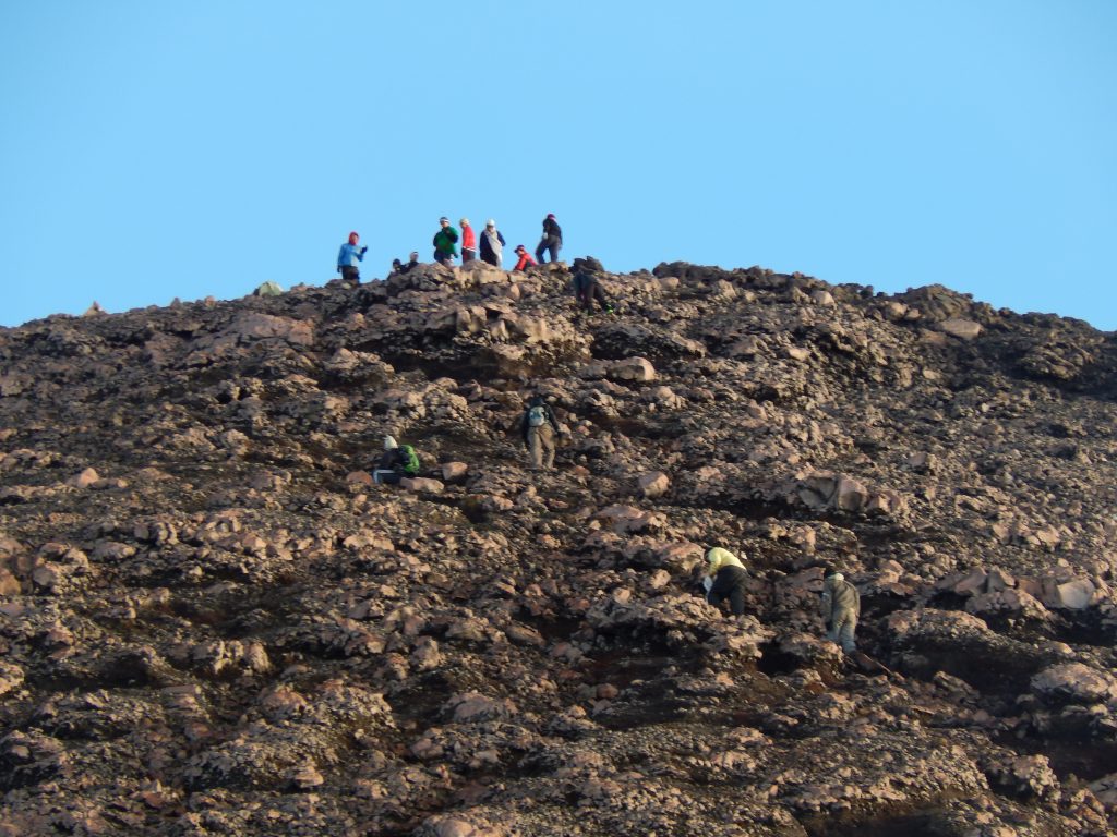
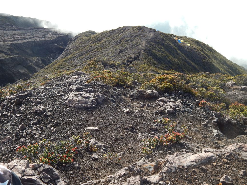
After descending the initial ridge, I took the above picture of Gunung Kerinci’s summit. If you observe closely, you can spot people standing on the summit, providing a sense of distance. It was fascinating to witness the ridge we had just descended in daylight. The slippery scree section was undoubtedly the most nerve-wracking. Approximately an hour later, near Shelter 3, I captured the pictures below. Kimon and I took a brief break at Shelter 3.
Back in the Jungle
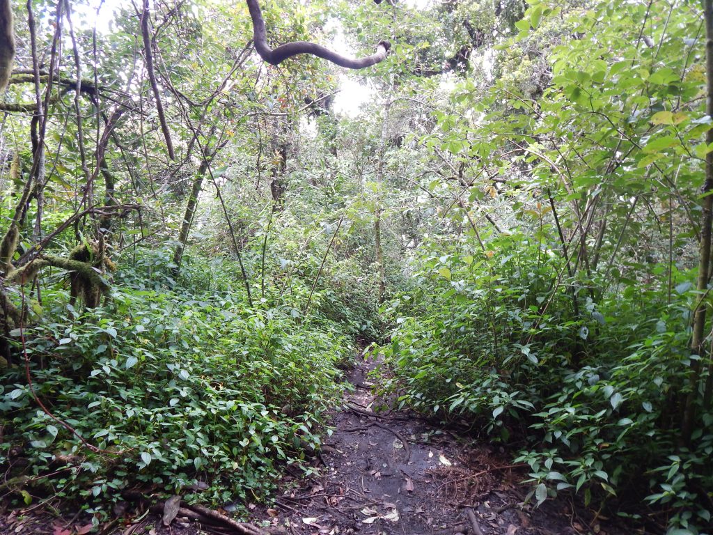
Descending from Shelter 3 to Shelter 2 involved navigating through the jungle once again. With a firmer grip on the terrain (due to the absence of rocks or gravel), we were able to accelerate our descent. This portion of the journey took a toll on my knees, and they were sore upon reaching Shelter 2. Never underestimate the challenges of the descent!
At Shelter 2, Kimon prepared a meal and informed me that we would depart in an hour. I discarded some of my clothing, opting to wear only pants and trousers, along with a raincoat for our departure from Shelter 2. My clothes were drenched from sweat, and my body felt overheated, with sweat dripping from my face upon our arrival at Shelter 2. I lay down, exhausted, for an hour, marveling at Kimon’s physical stamina as he promptly began dismantling his tent and the overhead protection.
After changing into fresh clothes, I emerged from my tent and engaged in some leg movement exercises to alleviate the stiffness that had set in so quickly from the brief rest—quite insane! Kimon chuckled as he observed my plight. I took a stroll around the campground to loosen my muscles before packing my bag. Kimon handled the task of packing my tent, and by around 11 am, we set out from Shelter 2 to Shelter 1 at a cautious pace. My knees were once again causing intense pain, particularly during the steep sections where I had to navigate jumps of 1.5 meters. The jarring impact of the landings was certainly not conducive to the well-being of my knees.
Back to Kersik Tuo
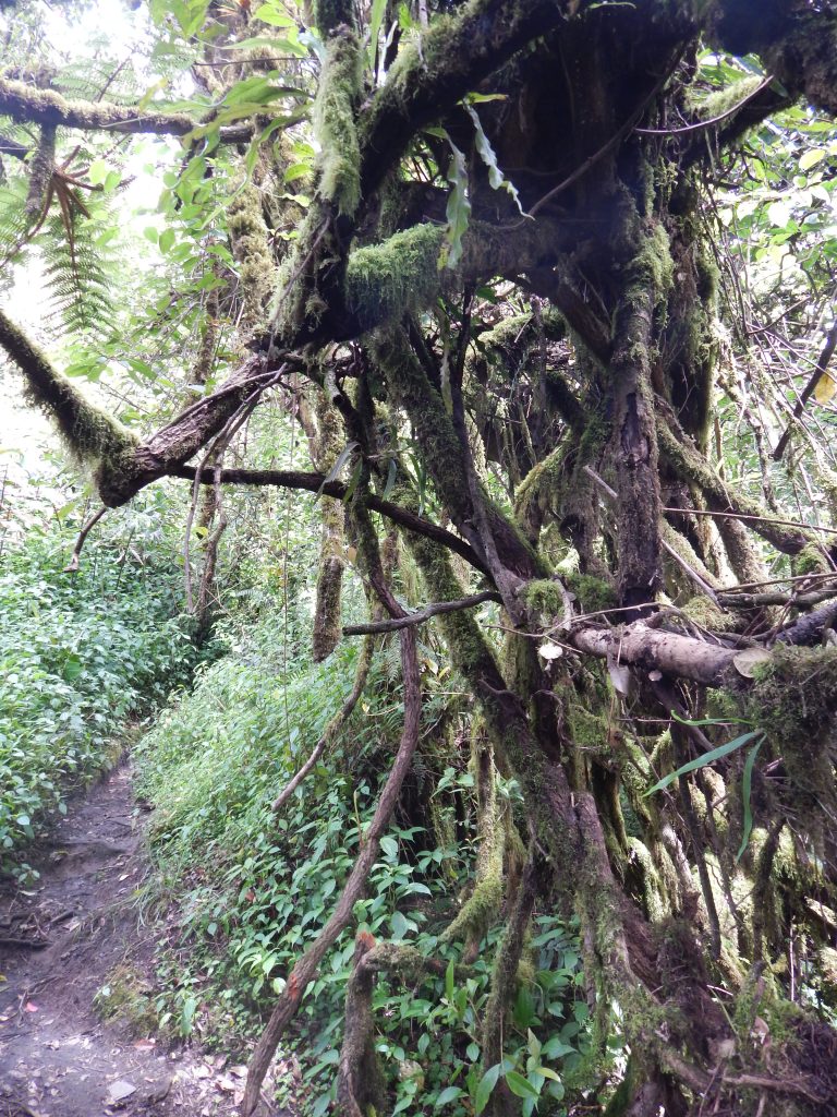
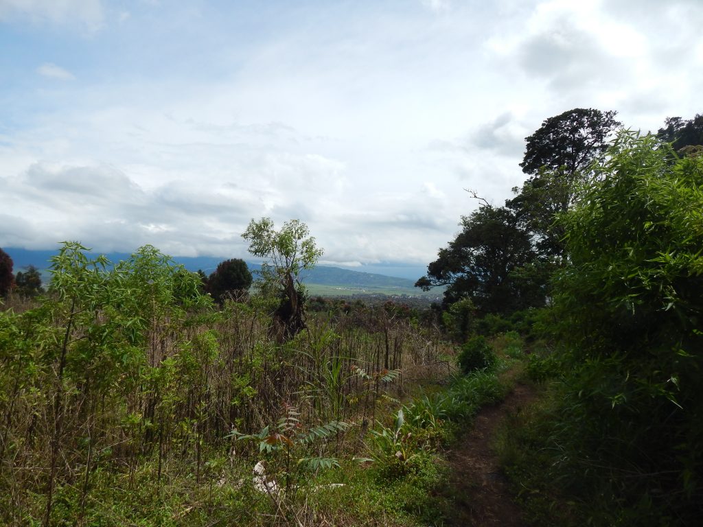
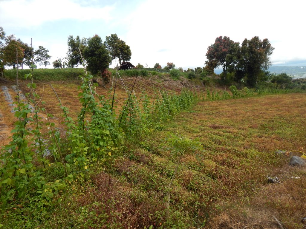
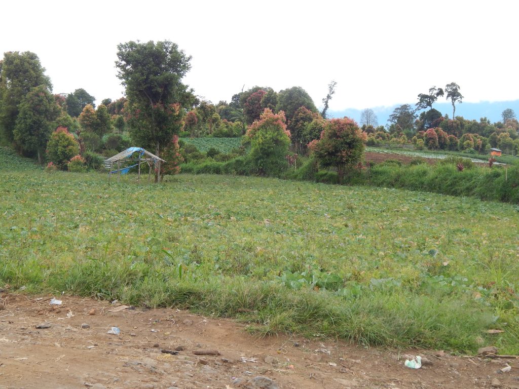
From Shelter 1 onward, Kimon suggested I take the lead to set our pace, perhaps a bit tired of waiting for me. The jungle canopy was less dense in this section, allowing more sunlight to illuminate the surroundings. As I mentioned yesterday, this leg of the hike was relatively straightforward, and I successfully picked up my pace. The elevation gradually decreased, with only a few challenging sections. We took a break at Pos 3, where I captured some final pictures of the jungle.
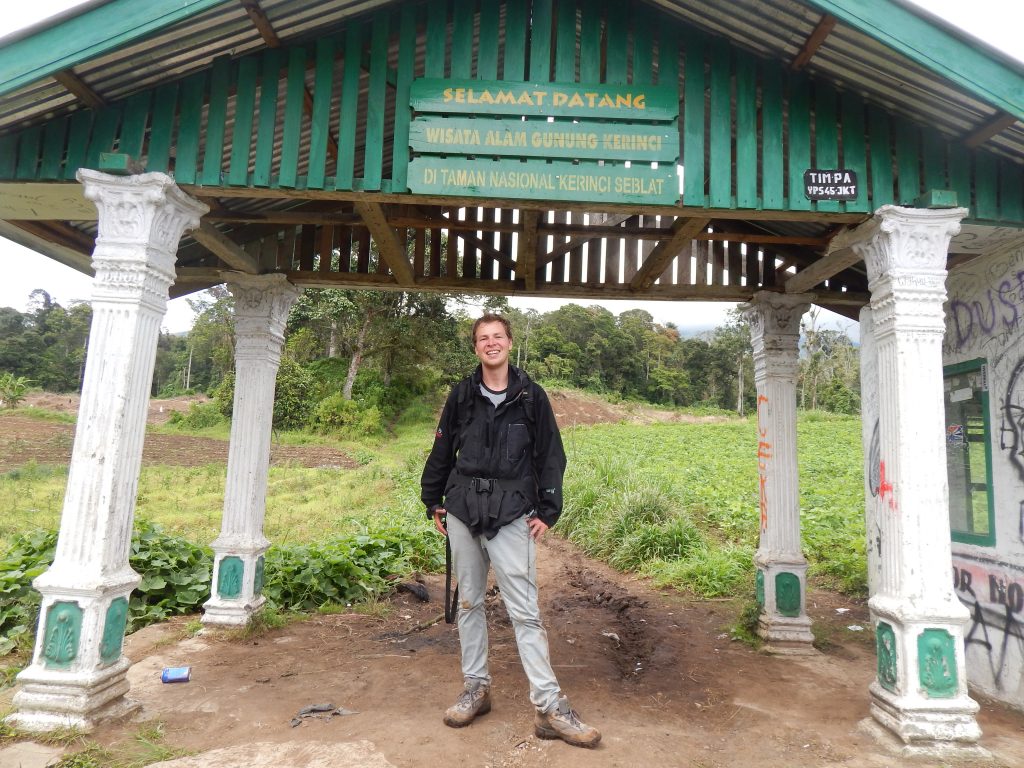
We quickened our pace from Pos 3 and emerged from the jungle around 2 pm. At last, a sense of achievement washed over me—I had made it, survived this adventure, haha. I took some pictures in front of the entrance, and we proceeded to the main road, where Mr. Subandi awaited us on his moped.
My First Indonesian Shower
Back at the homestay, I experienced the mandi for the first time since there was no Western shower in my bathroom. Without any other option, I decided to wash. I was utterly tired of the sweat and my unpleasant odor. The mandi was filled with cold water, but at that point, I couldn’t care less. ‘Suck it up, don’t complain,’ I thought while shivering.
In the end, I felt rejuvenated, relishing the sensation of being clean again, haha. After changing into fresh clothes, I realized I needed to do laundry as I was running out of wearable outfits. As soon as I reached Subandi Homestay, I promptly arranged a ticket with Mr. Subandi’s assistance. That evening, I was scheduled to depart for Padang in a minivan. It was a night journey, and I needed to be ready for the pick-up at 9 pm.